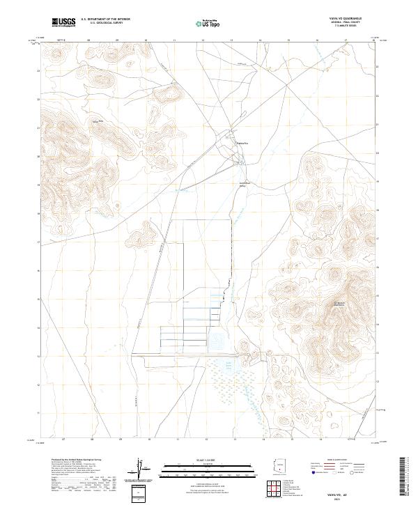
2021 Map of Vaiva Vo
USGS Topo · Published 2021About this map
The settlement of Vaiva Vo anchors this modern survey of the Tohono O'odham landscape in the Santa Rosa Valley. Situated in Pinal County, the map details the intersection of Joaquin Rd and Indian Rte 42, where community infrastructure meets the arid geography of the Sonoran Desert. To the east, the Tat Momoli Mountains rise sharply from the valley floor, while the Vaiva Hills define the northwestern terrain. Hydrological features such as Santa Rosa Wash and Mesa Wash illustrate the drainage patterns essential to this region, flowing toward Lake Saint Clair in the southern portion of the quadrangle. The map provides a clear view of the sparse road network and seasonal watercourses that have historically dictated movement and land use across these ancestral lands.
Find a feature on this map
15 named features on this map. Tap any name to fly to it.
Don’t see what you’re looking for? This feature index may not catch every label — zoom into the map to look around manually.
Map Details
Editions of this 2021 Vaiva Vo Map
This is the sole edition of this map. No revisions or reprints were ever made.
Other maps of this area

1922 · Casa Grande
USGS Topo · 1:62,500

1924 · Casa Grande
USGS Topo · 1:62,500

1941 · Vekol Mountains
USGS Topo · 1:62,500

1942 · Silver Reef Mountains
USGS Topo · 1:62,500

1942 · Vekol Mountains
USGS Topo · 1:62,500

1946 · Antelope Peak
USGS Topo · 1:62,500

1948 · Antelope Peak
USGS Topo · 1:62,500

1953 · Ajo
USGS Topo · 1:250,000

1956 · Tucson
USGS Topo · 1:250,000

1957 · Ajo
USGS Topo · 1:250,000