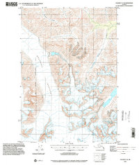
1993 Map of Valdez C-8
USGS Topo · Published 2002About this map
Nelchina Glacier dominates this landscape, its expansive ice field marked by extensive crevasses and topographical contours that reveal a dramatic glacial drainage system. Flowing through the high terrain of the Matanuska-Susitna Borough Boundary East, the ice feeds into the headwaters of several drainages, including Klanelneechena Creek and Barnette Creek. This 1993 update, which utilized planimetry from modern imagery, highlights the structural complexity of the glacier's surface as it appeared in the late twentieth century. The map provides a precise record of the borough line and the rugged watercourses that define this part of the Alaska interior, offering essential data for understanding the historical movement and form of these massive ice bodies before further changes in the subarctic environment.
Find a feature on this map
5 named features on this map. Tap any name to fly to it.
Don’t see what you’re looking for? This feature index may not catch every label — zoom into the map to look around manually.
Map Details
Editions of this 1993 Valdez C-8 Map
This is the sole edition of this map. No revisions or reprints were ever made.
Other maps of this area

1948 · Anchorage D-1
USGS Topo · 1:63,360

1949 · Valdez D-8
USGS Topo · 1:63,360

1949 · Valdez D-7
USGS Topo · 1:63,360

1951 · Valdez D-7
USGS Topo · 1:63,360

1951 · Anchorage
USGS Topo · 1:250,000

1951 · Anchorage D-1
USGS Topo · 1:63,360

1952 · Valdez D-8
USGS Topo · 1:63,360

1952 · Valdez
USGS Topo · 1:250,000

1960 · Valdez B-7
USGS Topo · 1:63,360

1960 · Valdez C-7
USGS Topo · 1:63,360