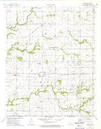
1974 Map of Valeda
USGS Topo · Published 1976About this map
The Old Indian Treaty Boundary cuts across this section of Labette County, marking a significant historical line in the landscape of southern Kansas. To the north, the small settlement of Angola serves as a waypoint for the Missouri - Kansas - Texas railroad, which angles diagonally across the terrain toward the Oklahoma border. The landscape is defined by the winding paths of Pumpkin Creek and Snow Creek, where the drainage patterns have dictated the placement of early homesteads and cemeteries.
Find a feature on this map
22 named features on this map. Tap any name to fly to it.
Don’t see what you’re looking for? This feature index may not catch every label — zoom into the map to look around manually.
Map Details
Editions of this 1974 Valeda Map
This is the sole edition of this map. No revisions or reprints were ever made.
Other maps of this area

1886 · Independence
USGS Topo · 1:125,000

1886 · Parsons
USGS Topo · 1:125,000

1893 · Parsons
USGS Topo · 1:125,000

1894 · Independence
USGS Topo · 1:125,000

1901 · Nowata
USGS Topo · 1:125,000

1901 · Vinita
USGS Topo · 1:125,000

1905 · Independence
USGS Topo · 1:125,000

1913 · Vinita
USGS Topo · 1:125,000

1914 · Nowata
USGS Topo · 1:125,000

1946 · Mound Valley
USGS Topo · 1:62,500