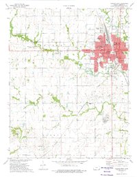
1973 Map of Parsons West
USGS Topo · Published 1975About this map
Parsons serves as a significant regional hub in the mid-1970s, defined by its complex infrastructure and institutional presence. The western portion of the city is dominated by the sprawling Parsons State Hospital and Labette Community Jr College, alongside a dense network of local education centers like Washington Sch and St Marys Sch. The landscape reflects a transition in transportation, where the active St Louis-San Francisco and Missouri-Kansas-Texas railroads intersect, while an Old Railroad Grade to the west hints at earlier transit corridors.
Find a feature on this map
43 named features on this map. Tap any name to fly to it.
Don’t see what you’re looking for? This feature index may not catch every label — zoom into the map to look around manually.
Map Details
Editions of this 1973 Parsons West Map
This is the sole edition of this map. No revisions or reprints were ever made.
Other maps of this area

1886 · Parsons
USGS Topo · 1:125,000

1893 · Parsons
USGS Topo · 1:125,000

1943 · McCune
USGS Topo · 1:62,500

1944 · Oswego
USGS Topo · 1:62,500

1945 · Mc Cune
USGS Topo · 1:62,500

1945 · Parsons
USGS Topo · 1:62,500

1946 · Oswego
USGS Topo · 1:48,000

1946 · Parsons
USGS Topo · 1:62,500

1946 · Mound Valley
USGS Topo · 1:62,500

1947 · Parsons
USGS Topo · 1:62,500