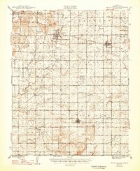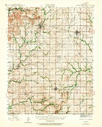
1946 Map of Mound Valley
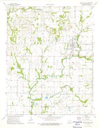
USGS Topo · Published 1965About this map
The agrarian landscape of Labette County is captured here during the mid-1940s, revealing a dense network of rural infrastructure including dozens of one-room schoolhouses like Cunningham Sch, Globe Sch, and Prairie Hill Sch. The area is anchored by the primary settlements of Mound Valley, Altamont, and Edna, which serve as hubs for the intersecting rail lines of the St Louis - San Francisco, Missouri Kansas - Texas, and Missouri Pacific railroads. The map highlights a transition in land use, where traditional farming near Dixon Mound and Pumpkin Creek exists alongside active petroleum exploration, indicated by numerous Oil wells scattered throughout the townships of Pleasant and Hackberry. A notable landmark of the era is the U S Auxiliary Landing Field, reflecting the regional military and aviation presence during the post-war period.
Find a feature on this map
66 named features on this map. Tap any name to fly to it.
Don’t see what you’re looking for? This feature index may not catch every label — zoom into the map to look around manually.
Map Details
Editions of this 1946 Mound Valley Map
This is the sole edition of this map. No revisions or reprints were ever made.
Historical Maps of Altamont Through Time
8 maps found