
Loading...
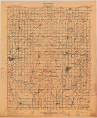
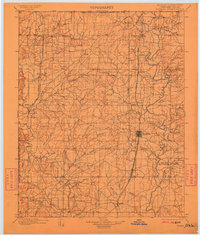
Loading map...1914 Map of Nowata
USGS Topo · Published 1914About this map
The Caney River and its many tributaries, including Hogshooter Creek and Little California Creek, define this region of northeastern Oklahoma just before the First World War. This 1914 survey captures a landscape densely dotted with rural social centers, particularly schools like Ramsey School, Witwer School, and Childers School. These institutions served small farming communities and settlements such as South Coffeyville, Lenapah, and Nowata.
Find a feature on this map
127 named features on this map. Tap any name to fly to it.
Don’t see what you’re looking for? This feature index may not catch every label — zoom into the map to look around manually.
Map Details
Date Portrayed1914
Date Published1914
PublisherU.S. Geological Survey
Map TypeTopographic
Scale1:125,000
Physical Dimensions16.5 x 19.6 inches
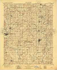
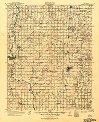
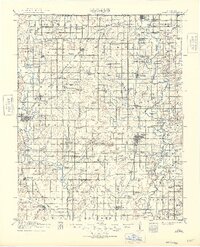
Editions of this 1914 Nowata Map
5 editions found
Historical Maps of Bartlesville Through Time
Featured Locations
Source Details
SourceU.S. Geological Survey
CopyrightPublic Domain