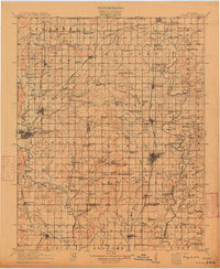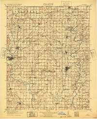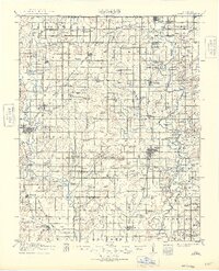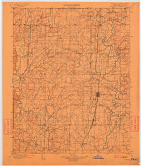
1914 Map of Nowata
USGS Topo · Published 1949About this map
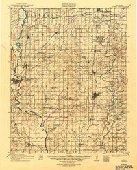
Nowata and Bartlesville anchor this pre-war survey of northeastern Oklahoma, a landscape defined by its burgeoning rail network and rural school districts. The Verdigris River and Caney River drain the territory, with the ST Louis Iron Mountain And Southern and Atchison Topeka And Santa Fe railroads providing the essential infrastructure for settlements like Lenapah, Talala, and Ramona. The map provides a detailed view of early 20th-century life through its dense concentration of rural education centers, including the uniquely named Dogtown School, Wingenot School, and Ramsey School. Along the northern edge, South Coffeyville sits just below the Oklahoma Kansas Boundary Line. Water features such as Chouteau Lake and Hogshooter Creek carve through the townships, while landmarks like Blue Mound and Iron Mountain rise above the surrounding plains. Smaller locales like Coodys Bluff and Alluwe are captured in their early development, prior to the major mid-century infrastructure changes in the region.
Find a feature on this map
134 named features on this map. Tap any name to fly to it.
Don’t see what you’re looking for? This feature index may not catch every label — zoom into the map to look around manually.
Map Details
Editions of this 1914 Nowata Map
5 editions found