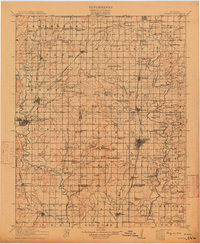
1914 Map of Nowata
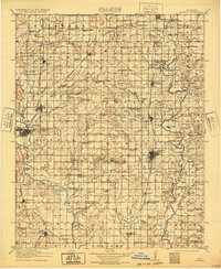
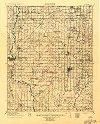
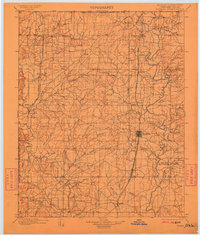
USGS Topo · Published 1949About this map
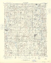
Bartlesville and Nowata serve as the primary hubs in this northeastern Oklahoma landscape, surveyed just years after statehood. The region is defined by a dense network of early 20th-century railroads, including the ST Louis And San Francisco RR, Missouri Kansas And Texas RR, and the Atchison Topeka And Santa Fe RR, which facilitated the growth of rural post offices like Ayetla Wayside P.O. and Elliott P.O.. The Caney River and its many tributaries, such as Hogshooter Creek and Rice Creek, dominate the drainage pattern, while landmarks like Blue Mound and Iron Mountain rise above the surrounding plains. Genealogists will find an exceptional density of named country schools, from Cotton Valley School in the north to Ramsey School and York School, illustrating the early educational footprint of the Osage and Cherokee Nation borderlands.
Find a feature on this map
129 named features on this map. Tap any name to fly to it.
Don’t see what you’re looking for? This feature index may not catch every label — zoom into the map to look around manually.
Map Details
Editions of this 1914 Nowata Map
5 editions found