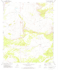
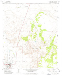
1978 Map of Valle Bonito
USGS Topo · Published 1978About this map
Valle Bonito unfolds across the high desert of Apache County, defined by a network of drainage systems and sparse water sources that dictate the pattern of human activity. The Zuni River cuts through the northwest corner, while the landscape is further carved by Long Wash, Pine Springs Wash, and Aguaje Draw. This 1970s survey captures the region's ranching character, centered on scattered improvements such as West Camp and a corral located near the Bean Patch Well.
Find a feature on this map
14 named features on this map. Tap any name to fly to it.
Don’t see what you’re looking for? This feature index may not catch every label — zoom into the map to look around manually.
Map Details
Editions of this 1978 Valle Bonito Map
This is the sole edition of this map. No revisions or reprints were ever made.
Other maps of this area

1886 · St Johns
USGS Topo · 1:250,000

1892 · St Johns
USGS Topo · 1:250,000

1954 · Saint Johns
USGS Topo · 1:250,000

1957 · Saint Johns
USGS Topo · 1:250,000

1958 · Saint Johns
USGS Topo · 1:250,000

1962 · Saint Johns
USGS Topo · 1:250,000
1974 · St. Johns North
USGS Topo · 1:24,000
1977 · Ceadro Spring
USGS Topo · 1:24,000
1977 · Kearn Lake
USGS Topo · 1:24,000
1977 · St. Johns North
USGS Topo · 1:24,000