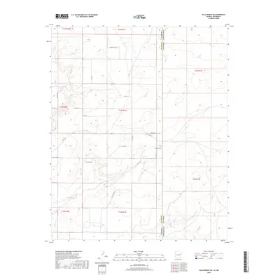
2018 Map of Valle Bonito NE
USGS Topo · Published 2018About this map
Bonito Valle and the surrounding high plateau of Apache County are captured here in a 2018 survey, just at the edge of the Arizona and New Mexico state line. This landscape is defined by the drainage of Aguaje Draw and the broad expanse of Deer Valley in the south. The map illustrates a modern rural development pattern where residential names like Good Sky, Cheyenne, and Easy St intersect with the old ranching routes of the region.
Find a feature on this map
32 named features on this map. Tap any name to fly to it.
Don’t see what you’re looking for? This feature index may not catch every label — zoom into the map to look around manually.
Map Details
Editions of this 2018 Valle Bonito NE Map
This is the sole edition of this map. No revisions or reprints were ever made.
Other maps of this area

1886 · St Johns
USGS Topo · 1:250,000

1892 · St Johns
USGS Topo · 1:250,000

1954 · Saint Johns
USGS Topo · 1:250,000

1957 · Saint Johns
USGS Topo · 1:250,000

1958 · Saint Johns
USGS Topo · 1:250,000

1962 · Saint Johns
USGS Topo · 1:250,000

1972 · Twentytwo Spring
USGS Topo · 1:24,000

1972 · Cantaralo Spring
USGS Topo · 1:24,000
1972 · Venadito Camp
USGS Topo · 1:24,000
1977 · Ceadro Spring
USGS Topo · 1:24,000