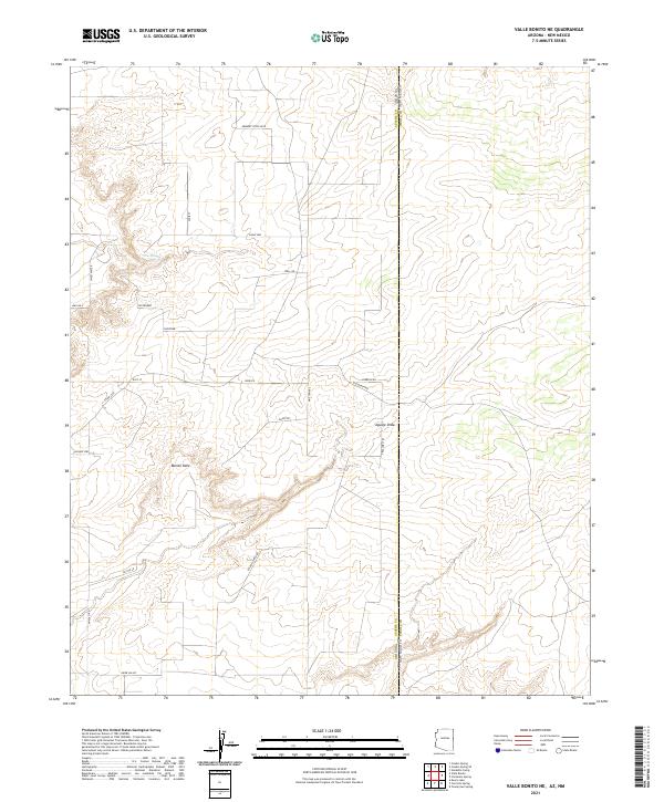
2021 Map of Valle Bonito NE
USGS Topo · Published 2021About this map
Bonito Valle sits at the heart of this high-altitude landscape where the Apache County and Cibola County line marks the intersection of Arizona and New Mexico. The terrain is defined by seasonal watercourses and drainages like Aguaje Draw and Pine Springs, with a road network that reflects a mix of modern naming and ranching heritage. Local routes such as Old Ranch Rd and Tractors Trl wind through the township and range divisions, while more established corridors like Herbert Pryce Blvd and Escadilla Mtn Rd provide access through the variable elevations of Deer Valley and toward the northern range boundaries.
Find a feature on this map
33 named features on this map. Tap any name to fly to it.
Don’t see what you’re looking for? This feature index may not catch every label — zoom into the map to look around manually.
Map Details
Editions of this 2021 Valle Bonito NE Map
This is the sole edition of this map. No revisions or reprints were ever made.
Other maps of this area

1886 · St Johns
USGS Topo · 1:250,000

1892 · St Johns
USGS Topo · 1:250,000

1954 · Saint Johns
USGS Topo · 1:250,000

1957 · Saint Johns
USGS Topo · 1:250,000

1958 · Saint Johns
USGS Topo · 1:250,000

1962 · Saint Johns
USGS Topo · 1:250,000

1972 · Twentytwo Spring
USGS Topo · 1:24,000

1972 · Cantaralo Spring
USGS Topo · 1:24,000
1972 · Venadito Camp
USGS Topo · 1:24,000
1977 · Ceadro Spring
USGS Topo · 1:24,000