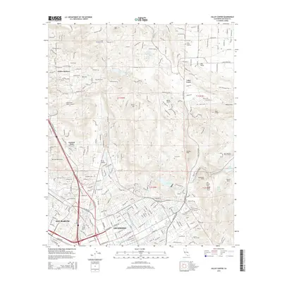
2015 Map of Valley Center
USGS Topo · Published 2015About this map
The expanding urban footprint of Escondido meets the citrus groves and rugged highlands of San Diego County in this 2015 study. The southern reaches of the map are defined by the grid of San Marcos and Escondido, where major corridors like W El Norte Pky and N Centre City Pky channel regional traffic. Moving north, the terrain transitions into the steep ridges of the Merriam Mountains and Oat Hills. This area is characterized by essential water infrastructure, including the San Diego Aqueduct and prominent storage sites like Dixon Reservoir and Lake Wohlford. Genealogy and local history researchers can identify established community landmarks such as Valley Center Cemetery and Oak Hill Memorial Park, alongside smaller communities like Jesmond Dene and Hidden Meadows. Distinctive engineering features, including the Red Mountain Tunnel and Oat Hills Tunnel, highlight the complex task of moving water through this high-relief landscape.
Find a feature on this map
251 named features on this map. Tap any name to fly to it.
Don’t see what you’re looking for? This feature index may not catch every label — zoom into the map to look around manually.
Map Details
Editions of this 2015 Valley Center Map
This is the sole edition of this map. No revisions or reprints were ever made.
Other maps of this area

1893 · Escondido
USGS Topo · 1:62,500

1901 · Escondido
USGS Topo · 1:62,500

1901 · San Luis Rey
USGS Topo · 1:125,000

1903 · Ramona
USGS Topo · 1:125,000

1904 · Southern California Sheet No. 2
USGS Topo · 1:250,000

1939 · Palomar Mountain
USGS Topo · 1:62,500

1942 · Temecula
USGS Topo · 1:62,500

1942 · Escondido
USGS Topo · 1:62,500

1942 · Ramona
USGS Topo · 1:62,500

1947 · Ramona
USGS Topo · 1:62,500