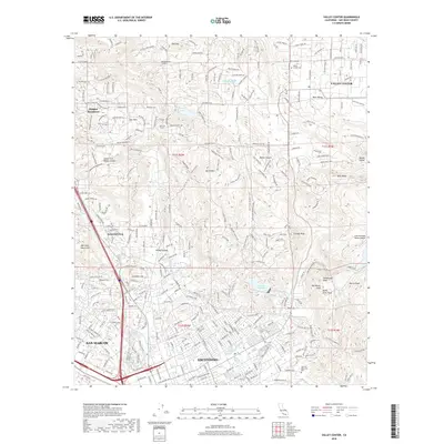
2018 Map of Valley Center
USGS Topo · Published 2018About this map
Escondido and the surrounding inland valleys of San Diego County are captured here during a period of significant suburban expansion and infrastructure management. The map reveals the critical role of water management in the region, tracing the San Diego Aqueduct as it moves across the landscape toward the Dixon Reservoir. Residential growth is evident in settlements like Hidden Meadows and Jesmond Dene, which contrast with the more rural character of Valley Center to the northeast. High peaks including Tombstone Peak, Bottle Peak, and Stanley Peak provide sharp elevation changes that define the local topography. This edition is particularly valuable for genealogists and local historians, as it precisely locates the Valley Center Cem and Oak Hill Memorial Park, alongside smaller landmarks like the Lake Wohlford Resort Airport and the Old Tank near Sage Trail.
Find a feature on this map
46 named features on this map. Tap any name to fly to it.
Don’t see what you’re looking for? This feature index may not catch every label — zoom into the map to look around manually.
Map Details
Editions of this 2018 Valley Center Map
This is the sole edition of this map. No revisions or reprints were ever made.
Other maps of this area

1893 · Escondido
USGS Topo · 1:62,500

1901 · Escondido
USGS Topo · 1:62,500

1901 · San Luis Rey
USGS Topo · 1:125,000

1903 · Ramona
USGS Topo · 1:125,000

1904 · Southern California Sheet No. 2
USGS Topo · 1:250,000

1939 · Palomar Mountain
USGS Topo · 1:62,500

1942 · Temecula
USGS Topo · 1:62,500

1942 · Escondido
USGS Topo · 1:62,500

1942 · Ramona
USGS Topo · 1:62,500

1947 · Ramona
USGS Topo · 1:62,500