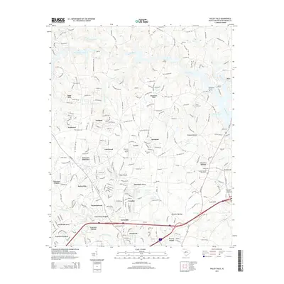
2014 Map of Valley Falls
USGS Topo · Published 2014About this map
Lake William C Bowen dominates the northern landscape of this Spartanburg County area, where the North Pacolet River and Pacolet River converge. The residential character of the region is defined by dozens of distinct neighborhoods and developments like Boiling Springs, Valley Falls, and Cherokee Springs. These settlements are linked by a dense network of local roads and major thoroughfares including Highway 9 and Us 221. Family history is deeply rooted here, evidenced by numerous small burial grounds such as Ezell Cem, Buck Creek Cem, and the Abbott Cem. The presence of the Pearson's Farm Airport and several localized lakes like Flatwood Lake and Waldrops Lake reflect the mid-century transition from a rural agricultural base to a more suburbanized landscape. Crossing points like Paris Bridge and Sandy Ford Bridge remain vital landmarks over the winding creek systems that feed the larger river basin.
Find a feature on this map
65 named features on this map. Tap any name to fly to it.
Don’t see what you’re looking for? This feature index may not catch every label — zoom into the map to look around manually.
Map Details
Editions of this 2014 Valley Falls Map
This is the sole edition of this map. No revisions or reprints were ever made.
Other maps of this area

1907 · Saluda
USGS Topo · 1:125,000

1935 · Greer
USGS Topo · 1:48,000

1938 · Greer
USGS Topo · 1:62,500

1941 · Spartanburg
USGS Topo · 1:250,000

1947 · Spartanburg
USGS Topo · 1:62,500

1949 · Spartanburg
USGS Topo · 1:24,000

1949 · Spartanburg
USGS Topo · 1:62,500

1953 · Spartanburg
USGS Topo · 1:250,000

1953 · Charlotte
USGS Topo · 1:250,000

1954 · Charlotte
USGS Topo · 1:250,000