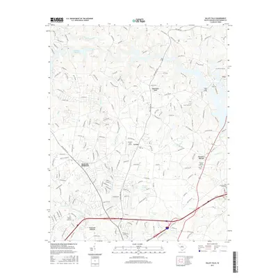
2017 Map of Valley Falls
USGS Topo · Published 2017About this map
Valley Falls and the rapidly growing area of Boiling Springs define the landscape of this Spartanburg County region. The northern reaches are dominated by the waters of Lake William C Bowen, formed by the damming of the Pacolet River and the North Pacolet River. This 2017 study illustrates the intersection of suburban expansion and traditional rural features, where institutions like the Sherman Coll of Chiropractic sit within a network of older settlements such as Cherokee Springs and Mountain View. The mapping of several family and community burial grounds, including the Carlisle Cem and Buck Creek Cem, provides essential points for genealogical research. Smaller water bodies like Flatwood Lake and Waldrops Lake dot the terrain south of the Pearson's Farm Airport, while Lawsons Fork Creek flows toward the southern boundary of the map.
Find a feature on this map
194 named features on this map. Tap any name to fly to it.
Don’t see what you’re looking for? This feature index may not catch every label — zoom into the map to look around manually.
Map Details
Editions of this 2017 Valley Falls Map
This is the sole edition of this map. No revisions or reprints were ever made.
Other maps of this area

1907 · Saluda
USGS Topo · 1:125,000

1935 · Greer
USGS Topo · 1:48,000

1938 · Greer
USGS Topo · 1:62,500

1941 · Spartanburg
USGS Topo · 1:250,000

1947 · Spartanburg
USGS Topo · 1:62,500

1949 · Spartanburg
USGS Topo · 1:24,000

1949 · Spartanburg
USGS Topo · 1:62,500

1953 · Spartanburg
USGS Topo · 1:250,000

1953 · Charlotte
USGS Topo · 1:250,000

1954 · Charlotte
USGS Topo · 1:250,000