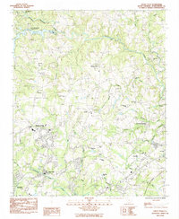
1983 Map of Valley Falls
USGS Topo · Published 1983About this map
Lawsons Fork Creek and the North Pacolet River define the hydraulic landscape of this Spartanburg County region as it was surveyed in the late 1970s. The map captures the suburbanization around Valley Falls and Boiling Springs, where residential clusters begin to transition into the more rural uplands of the Piedmont. The northern reaches are dominated by the South Pacolet River Reservoir No 1, reflecting mid-century water management efforts. Rural life remains anchored by numerous local landmarks, such as Rainbow Ch, Holden Chapel, and Foster Grove Sch. The area shows a distinct pattern of small settlements and family-named watercourses, including Betty Creek and Shoally Creek, which crisscross the rolling terrain. The presence of the Peach Valley Country Club and a Radio Facility near Flatwood Lake highlights the modernizing influences encroaching on the traditional agricultural landscape during this era.
Find a feature on this map
43 named features on this map. Tap any name to fly to it.
Don’t see what you’re looking for? This feature index may not catch every label — zoom into the map to look around manually.
Map Details
Editions of this 1983 Valley Falls Map
This is the sole edition of this map. No revisions or reprints were ever made.
Other maps of this area

1907 · Saluda
USGS Topo · 1:125,000

1935 · Greer
USGS Topo · 1:48,000

1938 · Greer
USGS Topo · 1:62,500

1941 · Spartanburg
USGS Topo · 1:250,000

1947 · Spartanburg
USGS Topo · 1:62,500

1949 · Spartanburg
USGS Topo · 1:24,000

1949 · Spartanburg
USGS Topo · 1:62,500

1953 · Spartanburg
USGS Topo · 1:250,000

1953 · Charlotte
USGS Topo · 1:250,000

1954 · Charlotte
USGS Topo · 1:250,000