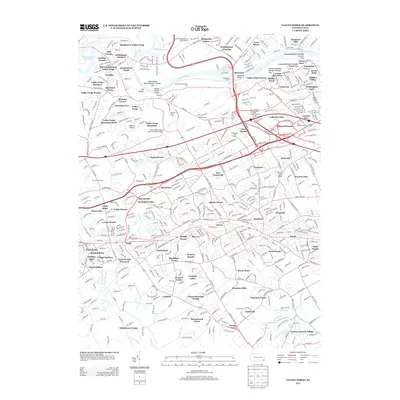
2013 Map of Valley Forge
USGS Topo · Published 2013About this map
Valley Forge and its surrounding townships show a complex landscape of commemorative landmarks and modern residential expansion along the Schuylkill River. The terrain is defined by the sharp relief of Mount Misery and Mount Joy, where the Valley Creek cuts a narrow Gorge before joining the river. Significant commemorative and infrastructure markers are prominent, including the Memorial Arch and the Knox-Valley Forge Dam Covered Bridge, which stand alongside newer developments such as Chesterbrook and Valley Forge Mountain North.
Find a feature on this map
111 named features on this map. Tap any name to fly to it.
Don’t see what you’re looking for? This feature index may not catch every label — zoom into the map to look around manually.
Map Details
Editions of this 2013 Valley Forge Map
This is the sole edition of this map. No revisions or reprints were ever made.
Other maps of this area

1894 · Chester
USGS Topo · 1:62,500

1894 · Norristown
USGS Topo · 1:62,500

1895 · Norristown
USGS Topo · 1:62,500

1896 · Norristown
USGS Topo · 1:62,500

1896 · Chester
USGS Topo · 1:62,500

1898 · Chester
USGS Topo · 1:62,500

1901 · Camden
USGS Topo · 1:125,000

1901 · West Chester
USGS Topo · 1:62,500

1904 · West Chester
USGS Topo · 1:62,500

1906 · Phoenixville
USGS Topo · 1:62,500
Featured Places
- Radnor Township, PA
- King of Prussia, Upper Merion Township
- Willistown Township, PA
- Charlestown Township, PA
- Chesterbrook, Tredyffrin Township