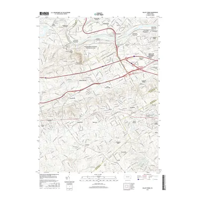
2016 Map of Valley Forge
USGS Topo · Published 2016About this map
Valley Forge National Historical Park dominates the northern landscape of this Pennsylvania survey, preserving the grounds of Mt Joy and Mt Misery above the Schuylkill River. The map meticulously details the transition from these protected parklands to the dense suburban development of the Main Line and surrounding communities. Notable landmarks like the Washington Memorial Chapel and the Knox-Valley Forge Dam Covered Bridge are situated near the banks of Valley Creek, while the southern reaches show established residential centers including Wayne, Berwyn, and Paoli.
Find a feature on this map
78 named features on this map. Tap any name to fly to it.
Don’t see what you’re looking for? This feature index may not catch every label — zoom into the map to look around manually.
Map Details
Editions of this 2016 Valley Forge Map
This is the sole edition of this map. No revisions or reprints were ever made.
Other maps of this area

1894 · Chester
USGS Topo · 1:62,500

1894 · Norristown
USGS Topo · 1:62,500

1895 · Norristown
USGS Topo · 1:62,500

1896 · Norristown
USGS Topo · 1:62,500

1896 · Chester
USGS Topo · 1:62,500

1898 · Chester
USGS Topo · 1:62,500

1901 · Camden
USGS Topo · 1:125,000

1901 · West Chester
USGS Topo · 1:62,500

1904 · West Chester
USGS Topo · 1:62,500

1906 · Phoenixville
USGS Topo · 1:62,500
Featured Places
- Radnor Township, PA
- King of Prussia, Upper Merion Township
- Willistown Township, PA
- Charlestown Township, PA
- Chesterbrook, Tredyffrin Township