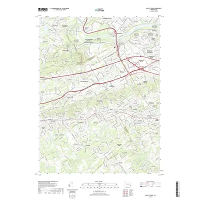
2019 Map of Valley Forge
USGS Topo · Published 2019About this map
The Valley Forge National Historical Park anchors this 2019 survey, preserving the Revolutionary War winter encampment site where Mt Joy and Mt Misery overlook the confluence of Valley Creek and the Schuylkill River. Beyond the park boundaries, the landscape transition is sharp, moving from the protected slopes of Jug Hollow into the dense suburban corridors of the Main Line and King of Prussia. This modern map reveals a dense layering of historical memory, where 18th-century burial grounds like the Diamond Rock Mennonite Cem and the Old Saint David Church Cem are surrounded by 21st-century developments.
Find a feature on this map
99 named features on this map. Tap any name to fly to it.
Don’t see what you’re looking for? This feature index may not catch every label — zoom into the map to look around manually.
Map Details
Editions of this 2019 Valley Forge Map
This is the sole edition of this map. No revisions or reprints were ever made.
Other maps of this area

1894 · Chester
USGS Topo · 1:62,500

1894 · Norristown
USGS Topo · 1:62,500

1895 · Norristown
USGS Topo · 1:62,500

1896 · Norristown
USGS Topo · 1:62,500

1896 · Chester
USGS Topo · 1:62,500

1898 · Chester
USGS Topo · 1:62,500

1901 · Camden
USGS Topo · 1:125,000

1901 · West Chester
USGS Topo · 1:62,500

1904 · West Chester
USGS Topo · 1:62,500

1906 · Phoenixville
USGS Topo · 1:62,500
Featured Places
- Radnor Township, PA
- King of Prussia, Upper Merion Township
- Willistown Township, PA
- Charlestown Township, PA
- Chesterbrook, Tredyffrin Township