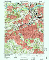
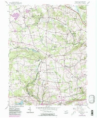
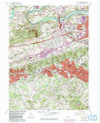
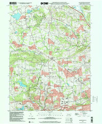
1992 Map of Valley Forge
USGS Topo · Published 1998This historical map portrays the area of Valley Forge in 1992, primarily covering Chester County as well as portions of Montgomery County and Delaware County. Featuring a scale of 1:24000, this map provides a highly detailed snapshot of the terrain, roads, buildings, counties, and historical landmarks in the Valley Forge region at the time. Published in 1998, it is the sole known edition of this map.
Find a feature on this map
107 named features on this map. Tap any name to fly to it.
Don’t see what you’re looking for? This feature index may not catch every label — zoom into the map to look around manually.
Map Details
Editions of this 1992 Valley Forge Map
This is the sole edition of this map. No revisions or reprints were ever made.
Historical Maps of Malvern Through Time
9 maps found

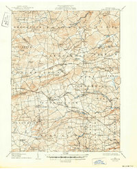
1905 Honey Brook
Chester County, PA
1907 Honeybrook
Chester County, PA

1941 Honeybrook
Chester County, PA
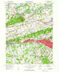
1952 Valley Forge
Chester County, PA
1955 Honey Brook
Chester County, PA
1956 Wagontown
Chester County, PA
1966 Valley Forge
Chester County, PA
1992 Valley Forge
Chester County, PA
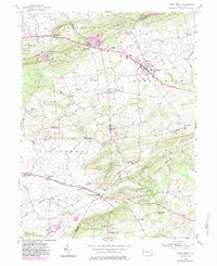
1999 Wagontown
Chester County, PA
Featured Locations
- Radnor Township, PA
- Charlestown Township, PA
- Willistown Township, PA
- King of Prussia, Upper Merion Township
- Chesterbrook, Tredyffrin Township