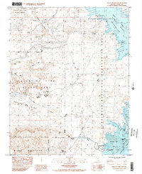
1984 Map of Valley of Fire East
USGS Topo · Published 1984About this map
Florence Mine No 1 and Florence Mine No 2 underscore the industrial character of this desert landscape, where mineral extraction follows the complex geology of Overton Ridge. The map details a region defined by the transition from the arid uplands of Valley of Fire State Park to the submerged geography of the Lake Mead National Recreation Area. Cultural history is anchored by the Grave Cpt John T Clark Memorial Monument and the Arrowhead Trail Historic Marker, indicating the early 20th-century travel routes that predated modern infrastructure. To the east, the rising waters of the Overton Arm have transformed the landscape near the former site of Kaolin, while prominent landmarks like Elephant Rock and Silica Dome provide stark navigational points against the basin of Lake Mead.
Find a feature on this map
45 named features on this map. Tap any name to fly to it.
Don’t see what you’re looking for? This feature index may not catch every label — zoom into the map to look around manually.
Map Details
Editions of this 1984 Valley of Fire East Map
2 editions found
Other maps of this area

1886 · Saint Thomas
USGS Topo · 1:250,000

1893 · Saint Thomas
USGS Topo · 1:250,000

1926 · Bonelli
USGS Topo · 1:96,000

1926 · Boulder Canyon
USGS Topo · 1:96,000

1953 · Muddy Peak
USGS Topo · 1:62,500

1953 · Overton Beach
USGS Topo · 1:62,500

1954 · Las Vegas
USGS Topo · 1:250,000

1957 · Las Vegas
USGS Topo · 1:250,000

1958 · Moapa
USGS Topo · 1:62,500

1958 · Overton
USGS Topo · 1:62,500