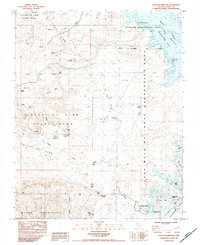
1984 Map of Valley of Fire East
USGS Topo · Published 1984About this map
Valley of Fire State Park anchors this desert landscape where the geology of Baseline Mesa and Silica Dome meets the waters of the Lake Mead Overton Arm. Historically significant markers appear near the road network, including the Grave Cpt John J Clark Memorial Monument and the Arrowhead Trail Historic Marker, indicating the early travel routes that once crossed this arid terrain.
Find a feature on this map
43 named features on this map. Tap any name to fly to it.
Don’t see what you’re looking for? This feature index may not catch every label — zoom into the map to look around manually.
Map Details
Editions of this 1984 Valley of Fire East Map
2 editions found
Other maps of this area

1886 · Saint Thomas
USGS Topo · 1:250,000

1893 · Saint Thomas
USGS Topo · 1:250,000

1926 · Bonelli
USGS Topo · 1:96,000

1926 · Boulder Canyon
USGS Topo · 1:96,000

1953 · Muddy Peak
USGS Topo · 1:62,500

1953 · Overton Beach
USGS Topo · 1:62,500

1954 · Las Vegas
USGS Topo · 1:250,000

1957 · Las Vegas
USGS Topo · 1:250,000

1958 · Moapa
USGS Topo · 1:62,500

1958 · Overton
USGS Topo · 1:62,500