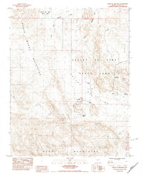
1984 Map of Valley of Fire West
USGS Topo · Published 1984About this map
Valley of Fire State Park centers this 1984 survey, revealing a landscape defined by significant geologic formations and early recreational development in Clark County. Notable landmarks such as Atlatl Rock, Beehive Rock, and the Fire Alcove indicate the area's importance for both natural history and prehistoric significance. The topography is anchored by the North Muddy Mountains to the west and the Muddy Mountains to the south, with drainage provided by the Valley of Fire Wash, Overton Wash, and the South Fork. While much of the land is preserved, scattered Prospects suggest historical mineral exploration. Established recreation sites, including Mouses Tank Picnic Area, Seven Sisters Picnic Area, and Sunrise Picnic Area, mark the footprint of tourism and public access during the mid-1980s.
Find a feature on this map
15 named features on this map. Tap any name to fly to it.
Don’t see what you’re looking for? This feature index may not catch every label — zoom into the map to look around manually.
Map Details
Editions of this 1984 Valley of Fire West Map
2 editions found
Other maps of this area

1886 · Saint Thomas
USGS Topo · 1:250,000

1893 · Saint Thomas
USGS Topo · 1:250,000

1926 · Bonelli
USGS Topo · 1:96,000

1926 · Boulder Canyon
USGS Topo · 1:96,000

1953 · Muddy Peak
USGS Topo · 1:62,500

1953 · Overton Beach
USGS Topo · 1:62,500

1954 · Las Vegas
USGS Topo · 1:250,000

1957 · Las Vegas
USGS Topo · 1:250,000

1958 · Moapa
USGS Topo · 1:62,500

1958 · Overton
USGS Topo · 1:62,500