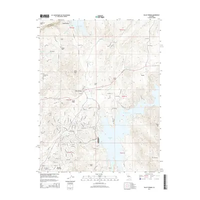
2015 Map of Valley Springs
USGS Topo · Published 2015About this map
Valley Springs and Rancho Calaveras anchor this transition between the Central Valley floor and the Sierra Nevada foothills. The landscape is defined by massive water management infrastructure, most notably the Mokelumne Aqueduct which draws from the Pardee Reservoir and passes through the Pardee Tunnel toward the west. To the east, the sprawling waters of New Hogan Lake dominate the drainage of the Calaveras River, while Camanche Reservoir clips the western edge of the quadrangle.
Find a feature on this map
101 named features on this map. Tap any name to fly to it.
Don’t see what you’re looking for? This feature index may not catch every label — zoom into the map to look around manually.
Map Details
Editions of this 2015 Valley Springs Map
This is the sole edition of this map. No revisions or reprints were ever made.
Other maps of this area

1889 · Jackson
USGS Topo · 1:125,000

1892 · Jackson
USGS Topo · 1:125,000

1897 · Jackson
USGS Topo · 1:125,000

1902 · Jackson
USGS Topo · 1:125,000

1941 · Sutter Creek
USGS Topo · 1:62,500

1944 · Valley Springs
USGS Topo · 1:62,500

1944 · Sutter Creek
USGS Topo · 1:62,500

1945 · San Andreas
USGS Topo · 1:62,500

1947 · San Andreas
USGS Topo · 1:62,500

1947 · Sacramento
USGS Topo · 1:250,000