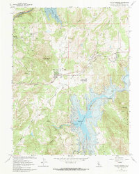
2021 Map of Valley Springs
USGS Topo · Published 2021About this map
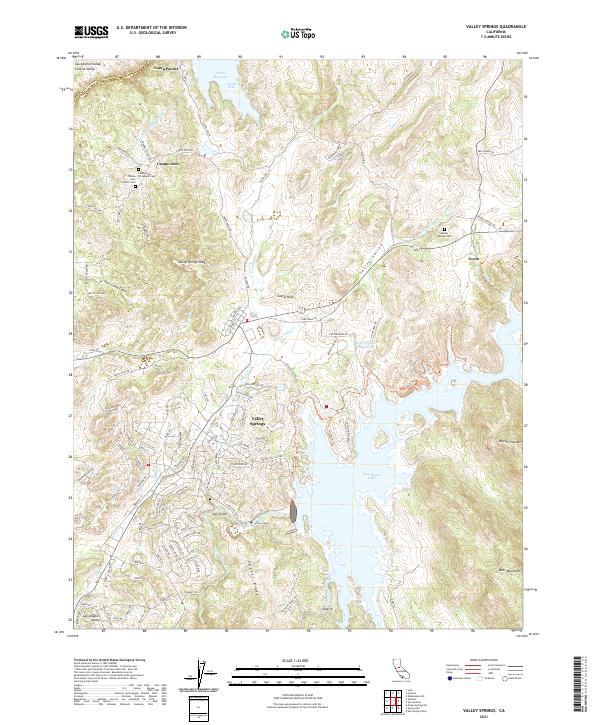
Valley Springs serves as the focal point of this 2021 landscape, situated where the lowlands of the Sacramento Valley and Central Valley meet the rising terrain of Gopher Ridge and the Bear Mountains. The map reveals a region defined by modern water management and historical rural settlement, characterized by the expansive waters of New Hogan Lake and the Pardee Reservoir. Infrastructure is prominent, notably the Mokelumne Aqueduct passing near the community of Campo Seco. Genealogists will find significant value in the detailed plotting of local burial grounds, including the Campo Seco Protestant Cem, the Campo Seco Catholic Cem, and the Double Springs Cem near Toyon. From the peak of Buena Vista Mtn to the depths of Chili Camp Gulch, the topography illustrates the transition from river valleys to the Sierra Nevada foothills.
Find a feature on this map
125 named features on this map. Tap any name to fly to it.
Don’t see what you’re looking for? This feature index may not catch every label — zoom into the map to look around manually.
Map Details
Editions of this 2021 Valley Springs Map
This is the sole edition of this map. No revisions or reprints were ever made.
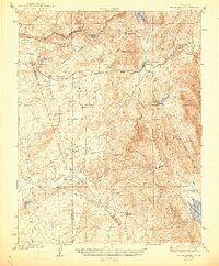
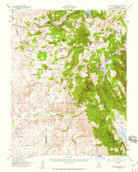
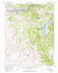
Historical Maps of Rancho Calaveras Through Time
5 maps found