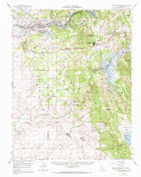
1962 Map of Valley Springs
USGS Topo · Published 1970About this map
The Mokelumne River and Calaveras River basins undergo significant structural change in this early 1960s survey, marked by blue hatching that indicates areas soon to be submerged by the New Hogan Reservoir and Camanche Reservoir. The landscape preserves a transition from ranching and mining to large-scale water management, with numerous tailing piles and mineral operations like the Penn Mine and Pluto Mine dotting the hills near Valley Springs.
Find a feature on this map
74 named features on this map. Tap any name to fly to it.
Don’t see what you’re looking for? This feature index may not catch every label — zoom into the map to look around manually.
Map Details
Editions of this 1962 Valley Springs Map
2 editions found
Other maps of this area

1889 · Jackson
USGS Topo · 1:125,000

1892 · Jackson
USGS Topo · 1:125,000

1894 · Lodi
USGS Topo · 1:125,000

1897 · Jackson
USGS Topo · 1:125,000

1902 · Jackson
USGS Topo · 1:125,000

1908 · Linden
USGS Topo · 1:31,680

1909 · Goose Creek
USGS Topo · 1:31,680

1909 · Clements
USGS Topo · 1:31,680

1915 · Trigo
USGS Topo · 1:31,680

1915 · Peters
USGS Topo · 1:31,680