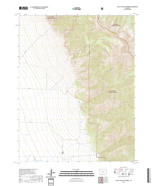
2022 Map of Valley View Hot Springs
USGS Topo · Published 2022About this map
Rio Grande National Forest and San Isabel National Forest dominate this high-altitude landscape along the border of Custer and Saguache counties. The terrain is defined by dramatic elevation changes, rising from the valley floor up through Steel Canyon and Lime Canyon toward the towering Cottonwood Peak. A network of historic irrigation projects and trails highlights the region's managed water and access, featuring the Hoffman Niedhardt Ditch and the Cotton Cr Ditch at the base of the mountains. For genealogists and local historians, the Cotton Creek Cem provides a specific point of interest near the southern edge of the survey. The extensive trail system, including the Hot Springs Trl and Major Creek Trl, illustrates the long-standing recreational and utilitarian pathways that carve through Orient Canyon and Black Canyon.
Find a feature on this map
35 named features on this map. Tap any name to fly to it.
Don’t see what you’re looking for? This feature index may not catch every label — zoom into the map to look around manually.
Map Details
Editions of this 2022 Valley View Hot Springs Map
This is the sole edition of this map. No revisions or reprints were ever made.
Other maps of this area

1950 · Valley View Hot Springs
USGS Topo · 1:24,000

1954 · Pueblo
USGS Topo · 1:250,000

1957 · Pueblo
USGS Topo · 1:250,000

1958 · Pueblo
USGS Topo · 1:250,000

1959 · Electric Peak
USGS Topo · 1:62,500

1959 · Howard
USGS Topo · 1:62,500

1959 · Cotopaxi
USGS Topo · 1:62,500

1962 · Pueblo
USGS Topo · 1:250,000

1966 · Pueblo
USGS Topo · 1:250,000
1967 · Valley View Hot Springs
USGS Topo · 1:24,000