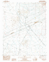
1983 Map of Valley Wells
USGS Topo · Published 1985About this map
Valley Wells serves as a focal point in this high-desert landscape of Shadow Valley, where the 1980s infrastructure of Interstate 15 intersects with earlier desert markers. The map reveals evidence of past habitation and industry through Ruins, several Tailings piles, and a small Cem located near a set of Water Tanks. This region's reliance on groundwater is evident in the notation of Windmills and a Rock Tank situated toward the south. The natural drainage of Kingston Wash cuts across the basin, framed by the foothills of the Mescal Range. The presence of a Valley Wells Safety Rest Area alongside various Gravel Pits and Borrow Pits highlights the area's role as a transit corridor and a source of materials for local highway development during this era.
Find a feature on this map
23 named features on this map. Tap any name to fly to it.
Don’t see what you’re looking for? This feature index may not catch every label — zoom into the map to look around manually.
Map Details
Editions of this 1983 Valley Wells Map
2 editions found
Other maps of this area

1910 · Ivanpah
USGS Topo · 1:250,000

1912 · Ivanpah
USGS Topo · 1:250,000

1942 · Ivanpah
USGS Topo · 1:250,000

1947 · Kingman
USGS Topo · 1:250,000

1948 · Kingman
USGS Topo · 1:250,000

1954 · Kingman
USGS Topo · 1:250,000

1955 · Kingman
USGS Topo · 1:250,000

1955 · Kingston Peak
USGS Topo · 1:62,500

1955 · Mescal Range
USGS Topo · 1:62,500

1956 · Halloran Spring
USGS Topo · 1:62,500