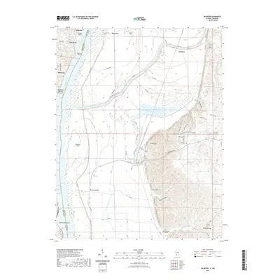
2021 Map of Valmeyer
USGS Topo · Published 2021About this map
The Mississippi River serves as the central artery and state boundary in this 2021 study, separating the riverfront communities of Imperial, Kimmswick, and Herculaneum on the Missouri side from the bottomlands of Monroe County, Illinois. The landscape is defined by the sharp contrast between the wide alluvial floodplain and the high bluffs to the east, where Valmeyer and Monroe City are situated. Large river features like Chesley Island and Meissner Island dominate the channel, while the interior is marked by Moredock Lake and the Corps of Engineers Levee Rd. For local historians and genealogists, the map identifies several distinct burial sites including Eagle Cliff Cem, Saint Johns Cem, and Wallace Cem. The settlement pattern reflects a deeply rooted connection to the river, with Harrisonville and Sulphur Springs occupying strategic points along the banks and rail lines.
Find a feature on this map
78 named features on this map. Tap any name to fly to it.
Don’t see what you’re looking for? This feature index may not catch every label — zoom into the map to look around manually.
Map Details
Editions of this 2021 Valmeyer Map
This is the sole edition of this map. No revisions or reprints were ever made.
Other maps of this area

1910 · Waterloo
USGS Topo · 1:62,500

1912 · Kimmswick
USGS Topo · 1:62,500

1913 · Waterloo
USGS Topo · 1:62,500

1915 · Renault
USGS Topo · 1:62,500

1915 · Crystal City
USGS Topo · 1:62,500

1916 · Kimmswick
USGS Topo · 1:62,500

1940 · Renault
USGS Topo · 1:62,500

1948 · Kimmswick
USGS Topo · 1:62,500

1949 · Saint Louis
USGS Topo · 1:250,000

1949 · Crystal City
USGS Topo · 1:62,500