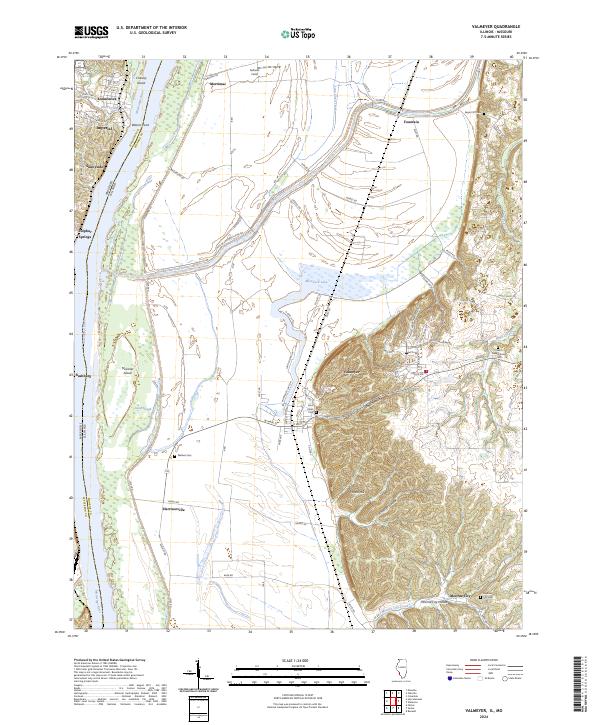
2024 Map of Valmeyer
USGS Topo · Published 2024About this map
Valmeyer sits at the foot of a prominent bluff line that separates the agricultural bottomlands of the Mississippi River from the upland terrain of Monroe County. This landscape is defined by the extensive Corps of Engineers Levee Rd system, which protects the low-lying fields and settlements like Harrisonville and Merrimac. The dramatic elevation change is most evident at Potato Hill and along the hollows of Woodland Ridge, where several historic burial sites such as Saint Johns Cem and Eagle Cliff Cem are situated on higher ground overlooking the river valley.
Find a feature on this map
78 named features on this map. Tap any name to fly to it.
Don’t see what you’re looking for? This feature index may not catch every label — zoom into the map to look around manually.
Map Details
Editions of this 2024 Valmeyer Map
This is the sole edition of this map. No revisions or reprints were ever made.
Other maps of this area

1910 · Waterloo
USGS Topo · 1:62,500

1912 · Kimmswick
USGS Topo · 1:62,500

1913 · Waterloo
USGS Topo · 1:62,500

1915 · Renault
USGS Topo · 1:62,500

1915 · Crystal City
USGS Topo · 1:62,500

1916 · Kimmswick
USGS Topo · 1:62,500

1940 · Renault
USGS Topo · 1:62,500

1948 · Kimmswick
USGS Topo · 1:62,500

1949 · Saint Louis
USGS Topo · 1:250,000

1949 · Crystal City
USGS Topo · 1:62,500