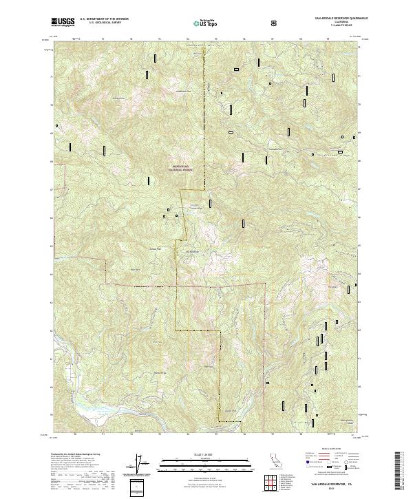
2021 Map of Van Arsdale Reservoir
USGS Topo · Published 2021About this map
The Eel Wild and Scenic River carves a deep path through the southern reaches of the Mendocino National Forest, defining the rugged topography of this borderland between Mendocino and Lake counties. At the heart of the lower drainage lies Van Arsdale Reservoir, a key piece of water infrastructure that serves as a focal point for the surrounding network of forest roads and logging paths. The landscape is punctuated by numerous named flats and glades, such as Deadmans Flat, Hatchet Flat, and Montgomery Glade, which often indicate historically significant landing spots or former camp locations within the timber-rich terrain. High elevations like Sanhedrin Mtn and High Peak offer vantage points over a complex system of ridges and canyons, including Erickson Ridge and North Ridge. This map illustrates the intersection of modern forestry management and older transportation routes like the Lake Co (Old Eel River Road).
Find a feature on this map
61 named features on this map. Tap any name to fly to it.
Don’t see what you’re looking for? This feature index may not catch every label — zoom into the map to look around manually.
Map Details
Editions of this 2021 Van Arsdale Reservoir Map
This is the sole edition of this map. No revisions or reprints were ever made.
Other maps of this area

1922 · Hullville
USGS Topo · 1:62,500

1929 · Eden Valley
USGS Topo · 1:62,500

1943 · Pomo
USGS Topo · 1:62,500

1951 · Lake Pillsbury
USGS Topo · 1:62,500

1952 · Hull Mountain
USGS Topo · 1:62,500

1952 · Eden Valley
USGS Topo · 1:62,500

1957 · Ukiah
USGS Topo · 1:250,000

1960 · Ukiah
USGS Topo · 1:250,000
1960 · Potter Valley
USGS Topo · 1:24,000

1960 · Potter Valley
USGS Topo · 1:62,500