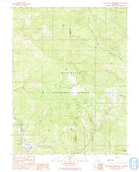
1991 Map of Van Arsdale Reservoir
USGS Topo · Published 1991About this map
The Eel River carves through the southern reaches of the Mendocino National Forest on this 1991 survey, where the Van Arsdale Reservoir and its associated dam facilities serve as a focal point for water management along the Mendocino and Lake County boundary. The landscape is characterized by numerous family-named peaks and clearings, such as Jordan Flat, Hatchet Flat, and Deadmans Flat, suggesting a legacy of early grazing or timber activity.
Find a feature on this map
40 named features on this map. Tap any name to fly to it.
Don’t see what you’re looking for? This feature index may not catch every label — zoom into the map to look around manually.
Map Details
Editions of this 1991 Van Arsdale Reservoir Map
This is the sole edition of this map. No revisions or reprints were ever made.
Other maps of this area

1922 · Hullville
USGS Topo · 1:62,500

1929 · Eden Valley
USGS Topo · 1:62,500

1943 · Pomo
USGS Topo · 1:62,500

1951 · Lake Pillsbury
USGS Topo · 1:62,500

1952 · Hull Mountain
USGS Topo · 1:62,500

1952 · Eden Valley
USGS Topo · 1:62,500

1957 · Ukiah
USGS Topo · 1:250,000

1960 · Ukiah
USGS Topo · 1:250,000
1960 · Potter Valley
USGS Topo · 1:24,000

1960 · Potter Valley
USGS Topo · 1:62,500