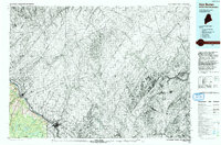
1993 Map of Van Buren
USGS Topo · Published 1993About this map
The Saint John River serves as the international boundary in this northern section of Aroostook Co, where the landscape of Maine meets New Brunswick. The settlement of Van Buren and the town of Hamlin are the primary population centers, situated along the river's path as it winds toward the Atlantic. To the south, the presence of Loring Air Force Base near Caswell indicates the strategic military importance of this border region during the late twentieth century. Compiled from earlier mid-century data but revised with 1989 aerial photography, this map captures the water infrastructure of the area, including the Van Buren Reservoir and the Sisson Branch Reservoir. The network of secondary roads and local township boundaries reveals a region defined by its timber-producing geography and its proximity to the Canadian border.
Find a feature on this map
12 named features on this map. Tap any name to fly to it.
Don’t see what you’re looking for? This feature index may not catch every label — zoom into the map to look around manually.
Map Details
Editions of this 1993 Van Buren Map
This is the sole edition of this map. No revisions or reprints were ever made.
Other maps of this area

1921 · Van Buren
USGS Topo · 1:250,000

1927 · Stockholm
USGS Topo · 1:48,000

1929 · Caribou
USGS Topo · 1:48,000

1930 · Fort Fairfield
USGS Topo · 1:48,000

1931 · Van Buren
USGS Topo · 1:48,000

1931 · Stockholm
USGS Topo · 1:62,500

1932 · Caribou
USGS Topo · 1:62,500

1933 · Fort Fairfield
USGS Topo · 1:62,500

1934 · Van Buren
USGS Topo · 1:62,500

1938 · Grand Isle
USGS Topo · 1:62,500