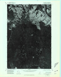
1975 Map of Van Buren SW
USGS Topo · Published 1981About this map
The international border between New Brunswick and Maine defines the northeastern corner of this 1975 orthophotoquad, where the United States and Canada share a heavily forested and agricultural boundary. The landscape is characterized by a sharp transition from the cleared farm plots in the north to the dense, dark timberlands of the south. Waterways like Hammond Brook snake through the interior, feeding into secluded bodies of water such as Big Black Brook Lake and the smaller Martin Lake. Rising above the surrounding lowlands, Doyle Ridge provides a distinct topographic landmark in an area dominated by commercial forestry and remote wetlands. This aerial perspective, captured just before the 1980s, offers researchers a clear view of land-use patterns and property boundaries along this remote stretch of the border.
Find a feature on this map
6 named features on this map. Tap any name to fly to it.
Don’t see what you’re looking for? This feature index may not catch every label — zoom into the map to look around manually.
Map Details
Editions of this 1975 Van Buren SW Map
This is the sole edition of this map. No revisions or reprints were ever made.
Other maps of this area

1921 · Van Buren
USGS Topo · 1:250,000

1927 · Stockholm
USGS Topo · 1:48,000

1929 · Caribou
USGS Topo · 1:48,000

1930 · Fort Fairfield
USGS Topo · 1:48,000

1931 · Van Buren
USGS Topo · 1:48,000

1931 · Stockholm
USGS Topo · 1:62,500

1932 · Caribou
USGS Topo · 1:62,500

1933 · Fort Fairfield
USGS Topo · 1:62,500

1934 · Van Buren
USGS Topo · 1:62,500

1951 · Van Buren
USGS Topo · 1:62,500