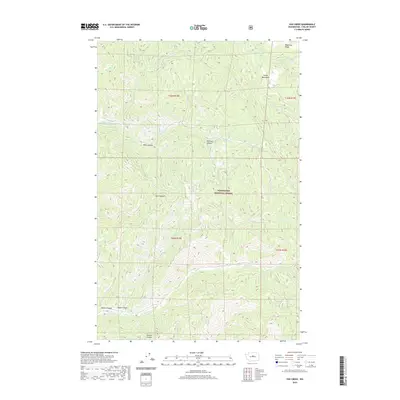
2020 Map of Van Creek
USGS Topo · Published 2020About this map
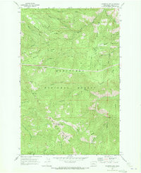
The Entiat Mountains dominate this 2020 topographic study of the Wenatchee National Forest, where a complex system of ridges and canyons defines the drainage patterns of central Washington. The high ground of Medicine Ridge transitions into deep incisions like Railroad Canyon and Moon Canyon, illustrating the erosive power of seasonal waterways. Water sources are critical landmarks in this environment, with Medicine Spring and Mud Spring providing notable points of interest along the upper elevations. The network of creeks, including Chumstick Cr, Tillicum Cr, and Van Cr, creates a dendritic pattern across the townships. This map provides a clear record of the modern forest road system and land management boundaries within T26N and T25N, documenting the remote landscape of Chelan County for forestry and recreation.
Find a feature on this map
23 named features on this map. Tap any name to fly to it.
Don’t see what you’re looking for? This feature index may not catch every label — zoom into the map to look around manually.
Map Details
Editions of this 2020 Van Creek Map
This is the sole edition of this map. No revisions or reprints were ever made.
Other maps of this area

1901 · Chelan
USGS Topo · 1:125,000

1901 · Chiwaukum
USGS Topo · 1:125,000

1904 · Chiwaukum
USGS Topo · 1:125,000

1957 · Wenatchee
USGS Topo · 1:250,000

1964 · Leavenworth
USGS Topo · 1:62,500
1968 · Cashmere
USGS Topo · 1:24,000

1968 · Tyee Mtn.
USGS Topo · 1:24,000
1968 · Sugarloaf Peak
USGS Topo · 1:24,000
1968 · Plain
USGS Topo · 1:24,000
1968 · Chumstick Mtn
USGS Topo · 1:24,000