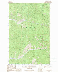
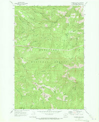
1989 Map of Van Creek
USGS Topo · Published 1989About this map
The Entiat Mountains dominate the landscape of this 1980s Chelan County study, where narrow canyons and steep ridges define the regional topography. Much of the area is protected as part of the Wenatchee National Forest, reflecting a land use pattern centered on timber and natural resource management. The Chumstick Railroad follows the winding path of Chumstick Creek, providing a critical transportation link through the rugged interior. Local industrial activity is evidenced by a Quarry and a Borrow Pit, while numerous named drainage systems like Walker Canyon, Clark Canyon, and Bjork Canyon carve into the high country. Above the valleys, Medicine Ridge and the Entiat Mountains overlook the confluence of smaller tributaries such as Eagle Creek and East Van Creek, illustrating the complex hydrology of the Cascade foothills.
Find a feature on this map
23 named features on this map. Tap any name to fly to it.
Don’t see what you’re looking for? This feature index may not catch every label — zoom into the map to look around manually.
Map Details
Editions of this 1989 Van Creek Map
This is the sole edition of this map. No revisions or reprints were ever made.
Other maps of this area

1901 · Chelan
USGS Topo · 1:125,000

1901 · Chiwaukum
USGS Topo · 1:125,000

1904 · Chiwaukum
USGS Topo · 1:125,000

1957 · Wenatchee
USGS Topo · 1:250,000

1964 · Leavenworth
USGS Topo · 1:62,500
1968 · Cashmere
USGS Topo · 1:24,000

1968 · Tyee Mtn.
USGS Topo · 1:24,000
1968 · Sugarloaf Peak
USGS Topo · 1:24,000
1968 · Plain
USGS Topo · 1:24,000
1968 · Chumstick Mtn
USGS Topo · 1:24,000