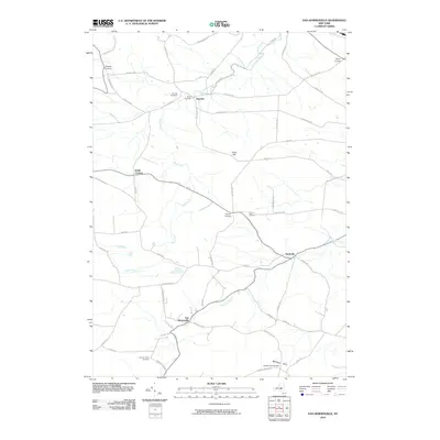
2010 Map of Van Hornesville
USGS Topo · Published 2010About this map
Van Hornesville and the surrounding rural uplands of Herkimer and Montgomery Counties are defined by a network of winding creeks and family-named corners. In the southern portion of the map, Otsquago Creek flows toward Starkville, while Ohisa Creek and Nowadaga Creek carve through the north, passing settlements like Newville. The landscape is dotted with small, historically significant burying grounds, including Garlock Cemetery, Haupt Cemetery, and Hawn Cemetery, which anchor the various farming communities and family homesteads.
Find a feature on this map
54 named features on this map. Tap any name to fly to it.
Don’t see what you’re looking for? This feature index may not catch every label — zoom into the map to look around manually.
Map Details
Editions of this 2010 Van Hornesville Map
This is the sole edition of this map. No revisions or reprints were ever made.
Other maps of this area

1898 · Canajoharie
USGS Topo · 1:62,500

1900 · Little Falls
USGS Topo · 1:62,500

1900 · Canajoharie
USGS Topo · 1:62,500

1901 · Lassellsville
USGS Topo · 1:62,500

1902 · Canajoharie
USGS Topo · 1:62,500

1903 · Richfield Springs
USGS Topo · 1:62,500

1903 · Lassellsville
USGS Topo · 1:62,500

1903 · Little Falls
USGS Topo · 1:62,500

1939 · Little Falls
USGS Topo · 1:62,500

1943 · Jordanville
USGS Topo · 1:24,000