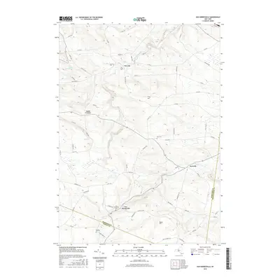
2016 Map of Van Hornesville
USGS Topo · Published 2016About this map
Van Hornesville and the winding valley of Otsquago Creek anchor this survey of the New York uplands, where the borders of Herkimer, Otsego, and Montgomery Counties meet. This rural landscape is defined by its deep agricultural and cemetery history, with numerous family-named landmarks such as Firey Hill and Willse Hill rise above the stream beds. Small settlements like Starkville, Newville, and Smith Corners dot the crossroads, connected by a network of rural routes such as Johnycake Road and Jordanville Road. For genealogists, the map is especially valuable for locating several smaller burial grounds including Haupt Cemetery, Garlock Cemetery, and the uniquely named Pumpkin Hook Cemetery. The terrain is deeply carved by water, with Nowadaga Creek and Ohisa Creek creating the narrow drainages that historically dictated the placement of roads and farmsteads.
Find a feature on this map
66 named features on this map. Tap any name to fly to it.
Don’t see what you’re looking for? This feature index may not catch every label — zoom into the map to look around manually.
Map Details
Editions of this 2016 Van Hornesville Map
This is the sole edition of this map. No revisions or reprints were ever made.
Other maps of this area

1898 · Canajoharie
USGS Topo · 1:62,500

1900 · Little Falls
USGS Topo · 1:62,500

1900 · Canajoharie
USGS Topo · 1:62,500

1901 · Lassellsville
USGS Topo · 1:62,500

1902 · Canajoharie
USGS Topo · 1:62,500

1903 · Richfield Springs
USGS Topo · 1:62,500

1903 · Lassellsville
USGS Topo · 1:62,500

1903 · Little Falls
USGS Topo · 1:62,500

1939 · Little Falls
USGS Topo · 1:62,500

1943 · Jordanville
USGS Topo · 1:24,000