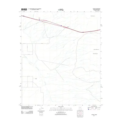
2011 Map of Vanar
USGS Topo · Published 2011About this map
Vanar occupies a high-desert corridor where the northern reaches of the Peloncillo Mountains meet the drainage basin of the San Simon River. This arid landscape is defined by its transit history, serving as a critical pass between the peaks of Steins Mountain and Attorney Mountain. The presence of the Cavot Interchange and the settlement at Barnes Ranch illustrates the transition from traditional ranching lands to modern interstate connectivity. Hydrological features like Vanar Wash and Steins Creek dictate the local topography, carving paths through the terrain that historical travelers and current residents alike must navigate. A network of rural routes, including Barnes Rd and W Ratliff Rd, provides access to the family-held lands and remote ranching outposts that characterize this borderlands region of Cochise County.
Find a feature on this map
18 named features on this map. Tap any name to fly to it.
Don’t see what you’re looking for? This feature index may not catch every label — zoom into the map to look around manually.
Map Details
Editions of this 2011 Vanar Map
This is the sole edition of this map. No revisions or reprints were ever made.
Other maps of this area

1917 · San Simon
USGS Topo · 1:125,000

1926 · Orange Butte
USGS Topo · 1:62,500

1928 · Chenoweth
USGS Topo · 1:62,500

1950 · San Simon
USGS Topo · 1:62,500

1950 · Vanar
USGS Topo · 1:62,500

1951 · Vanar
USGS Topo · 1:62,500

1951 · San Simon
USGS Topo · 1:62,500

1954 · Silver City
USGS Topo · 1:250,000

1958 · Silver City
USGS Topo · 1:250,000

1962 · Silver City
USGS Topo · 1:250,000