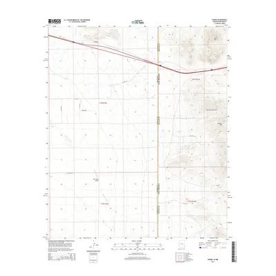
2014 Map of Vanar
USGS Topo · Published 2014About this map
Vanar sits at the high-desert transition where the San Simon Valley meets the rising elevations of the Peloncillo Mountains. This borderland landscape is defined by the interstate corridor and the north-south boundary between Arizona and New Mexico, cutting through a region of scattered ranch roads and ephemeral watercourses. To the east, the terrain becomes increasingly complex with landmarks like Steins Mtn and Attorney Mtn overlooking the drainage of Steins Cr. The arid valley floor is marked by the San Simon River and Vanar Wash, while a network of named tracks such as N Cavot Rd and Still Ridge Rd suggests the sparse, wide-open character of contemporary land use in this part of the Southwest.
Find a feature on this map
23 named features on this map. Tap any name to fly to it.
Don’t see what you’re looking for? This feature index may not catch every label — zoom into the map to look around manually.
Map Details
Editions of this 2014 Vanar Map
This is the sole edition of this map. No revisions or reprints were ever made.
Other maps of this area

1917 · San Simon
USGS Topo · 1:125,000

1926 · Orange Butte
USGS Topo · 1:62,500

1928 · Chenoweth
USGS Topo · 1:62,500

1950 · San Simon
USGS Topo · 1:62,500

1950 · Vanar
USGS Topo · 1:62,500

1951 · Vanar
USGS Topo · 1:62,500

1951 · San Simon
USGS Topo · 1:62,500

1954 · Silver City
USGS Topo · 1:250,000

1958 · Silver City
USGS Topo · 1:250,000

1962 · Silver City
USGS Topo · 1:250,000