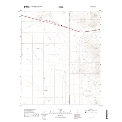
2018 Map of Vanar
USGS Topo · Published 2018About this map
Vanar sits at the edge of the Peloncillo Mountains along the Arizona and New Mexico border, serving as a distinct marker of the high desert passage between the two states. This 2018 survey documents the arid landscape of the San Simon Valley, where the seasonal waters of Vanar Wash cut through the terrain. The map illustrates the contemporary intersection of major transportation routes and the natural drainage patterns that have historically dictated movement through this borderland region. While the settlement itself is small, it remains a critical geographic point for those tracing the development of interstate corridors and the sparse, resilient habitation patterns of the Southwest.
Find a feature on this map
2 named features on this map. Tap any name to fly to it.
Don’t see what you’re looking for? This feature index may not catch every label — zoom into the map to look around manually.
Map Details
Editions of this 2018 Vanar Map
This is the sole edition of this map. No revisions or reprints were ever made.
Other maps of this area

1917 · San Simon
USGS Topo · 1:125,000

1926 · Orange Butte
USGS Topo · 1:62,500

1928 · Chenoweth
USGS Topo · 1:62,500

1950 · San Simon
USGS Topo · 1:62,500

1950 · Vanar
USGS Topo · 1:62,500

1951 · Vanar
USGS Topo · 1:62,500

1951 · San Simon
USGS Topo · 1:62,500

1954 · Silver City
USGS Topo · 1:250,000

1958 · Silver City
USGS Topo · 1:250,000

1962 · Silver City
USGS Topo · 1:250,000