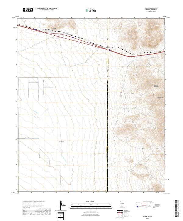
2021 Map of Vanar
USGS Topo · Published 2021About this map
The San Simon Valley dominates this high-desert borderland where the western reaches of the Peloncillo Mountains meet the Arizona and New Mexico state line. Centered on the settlement of Vanar, the landscape is defined by the intermittent flows of the San Simon River and Vanar Wash, carving paths through the arid terrain. To the east, the topography rises sharply toward Steins Mtn and Attorney Mtn, marking the transition from the valley floor to the rocky highlands. Local transit is captured through a network of rural routes, including Stagecoach Rd and Still Ridge Rd, which trace the historical movement across this rugged corridor. This survey preserves the modern configuration of ranching access and drainage patterns in a region historically vital for transcontinental passage.
Find a feature on this map
24 named features on this map. Tap any name to fly to it.
Don’t see what you’re looking for? This feature index may not catch every label — zoom into the map to look around manually.
Map Details
Editions of this 2021 Vanar Map
This is the sole edition of this map. No revisions or reprints were ever made.
Other maps of this area

1917 · San Simon
USGS Topo · 1:125,000

1926 · Orange Butte
USGS Topo · 1:62,500

1928 · Chenoweth
USGS Topo · 1:62,500

1950 · San Simon
USGS Topo · 1:62,500

1950 · Vanar
USGS Topo · 1:62,500

1951 · Vanar
USGS Topo · 1:62,500

1951 · San Simon
USGS Topo · 1:62,500

1954 · Silver City
USGS Topo · 1:250,000

1958 · Silver City
USGS Topo · 1:250,000

1962 · Silver City
USGS Topo · 1:250,000