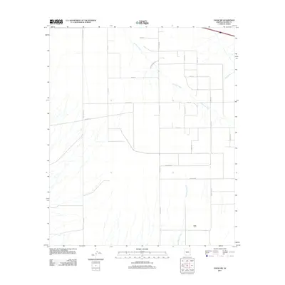
2011 Map of Vanar NW
USGS Topo · Published 2011About this map
San Simon River winds through this arid expanse of Cochise County, defining a landscape of ephemeral watercourses and scattered ranching interests. The terrain is characterized by broad alluvial fans where drainage features like Vanar Wash and East Whitetail Creek channel seasonal runoff from higher ground. This 2011 survey reveals a persistent network of rural infrastructure, from the prominent Wood Canyon Rd in the west to the family-named corridors of Marvin Barnes Rd and Phelps Rd further east. The presence of Boggs Ranch and the nearby Boggs Loop Rd suggests long-standing land use in an area where the grid of desert roads, including Eldon Rd and W Ratliff Rd, provides the primary framework for contemporary navigation and property boundaries.
Find a feature on this map
23 named features on this map. Tap any name to fly to it.
Don’t see what you’re looking for? This feature index may not catch every label — zoom into the map to look around manually.
Map Details
Editions of this 2011 Vanar NW Map
This is the sole edition of this map. No revisions or reprints were ever made.
Other maps of this area

1917 · San Simon
USGS Topo · 1:125,000

1926 · Cochise Head
USGS Topo · 1:62,500

1926 · Orange Butte
USGS Topo · 1:62,500

1928 · Chenoweth
USGS Topo · 1:62,500

1928 · Bowie
USGS Topo · 1:62,500

1949 · Bowie
USGS Topo · 1:62,500

1950 · San Simon
USGS Topo · 1:62,500

1950 · Bowie
USGS Topo · 1:62,500

1950 · Cochise Head
USGS Topo · 1:62,500

1950 · Vanar
USGS Topo · 1:62,500