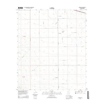
2014 Map of Vanar NW
USGS Topo · Published 2014About this map
San Simon Valley defines this section of Cochise County, where the desert landscape is structured by a grid of rural roads and seasonal watercourses. The drainage of the San Simon River and the meandering Vanar Wash cut through the arid terrain, creating natural corridors in an otherwise geometric landscape. The area is marked by long-established transit routes, including Wood Canyon Rd and the aptly named W Airmail Rd, reflecting the region's history of navigation and transport. Local land divisions are clearly defined by township and range lines, such as t14s r31e, illustrating the systematic settlement patterns that dictated the development of southeast Arizona. Ranching and land use are further evidenced by secondary connectors like Eldon Rd and N River Bottom Rd, which provide access to the intermittent flow of E Whitetail Cr.
Find a feature on this map
28 named features on this map. Tap any name to fly to it.
Don’t see what you’re looking for? This feature index may not catch every label — zoom into the map to look around manually.
Map Details
Editions of this 2014 Vanar NW Map
This is the sole edition of this map. No revisions or reprints were ever made.
Other maps of this area

1917 · San Simon
USGS Topo · 1:125,000

1926 · Cochise Head
USGS Topo · 1:62,500

1926 · Orange Butte
USGS Topo · 1:62,500

1928 · Chenoweth
USGS Topo · 1:62,500

1928 · Bowie
USGS Topo · 1:62,500

1949 · Bowie
USGS Topo · 1:62,500

1950 · San Simon
USGS Topo · 1:62,500

1950 · Bowie
USGS Topo · 1:62,500

1950 · Cochise Head
USGS Topo · 1:62,500

1950 · Vanar
USGS Topo · 1:62,500