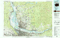
1979 Map of Vancouver
USGS Topo · Published 1980About this map
The confluence of the Columbia River and Willamette River anchors this 1979 survey, revealing the complex transit and water networks of the Pacific Northwest during a period of significant regional growth. Portions of Portland and Vancouver are shown in detail, including the heavy infrastructure of the Portland International Airport and the historic Vancouver Barracks. The map captures the industrial and academic character of the era through sites like the University of Portland and Reed College, while the surrounding landscape is defined by massive natural and managed areas such as the Gifford Pinchot National Forest and the Sauvie Island Wildlife Area.
Find a feature on this map
178 named features on this map. Tap any name to fly to it.
Don’t see what you’re looking for? This feature index may not catch every label — zoom into the map to look around manually.
Map Details
Editions of this 1979 Vancouver Map
2 editions found
Other maps of this area

1897 · Portland
USGS Topo · 1:62,500

1905 · Portland
USGS Topo · 1:62,500

1911 · Boring
USGS Topo · 1:48,000

1914 · Boring
USGS Topo · 1:62,500

1914 · Oregon City
USGS Topo · 1:62,500

1915 · Hillsboro
USGS Topo · 1:62,500

1916 · Tualatin
USGS Topo · 1:62,500

1916 · Estacada
USGS Topo · 1:125,000

1918 · Hillsboro
USGS Topo · 1:62,500

1918 · Troutdale
USGS Topo · 1:62,500