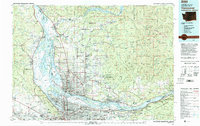
1979 Map of Vancouver
USGS Topo · Published 1993About this map
The Columbia River serves as the central artery for this late-1970s landscape, dividing the growing urban centers of Vancouver and Portland. This survey documents a critical period of regional expansion, showing the established grid of Fourth Plain and the concentration of academic and heritage sites including Clark College, University of Portland, and the Fort Vancouver National Historic Site. To the north and east, the industrial riverfronts of Camas and Washougal give way to the forested slopes of the Gifford Pinchot National Forest.
Find a feature on this map
300 named features on this map. Tap any name to fly to it.
Don’t see what you’re looking for? This feature index may not catch every label — zoom into the map to look around manually.
Map Details
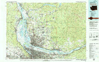
Editions of this 1979 Vancouver Map
2 editions found
Other maps of this area

1897 · Portland
USGS Topo · 1:62,500

1905 · Portland
USGS Topo · 1:62,500

1911 · Boring
USGS Topo · 1:48,000

1914 · Boring
USGS Topo · 1:62,500

1914 · Oregon City
USGS Topo · 1:62,500

1915 · Hillsboro
USGS Topo · 1:62,500

1916 · Tualatin
USGS Topo · 1:62,500

1916 · Estacada
USGS Topo · 1:125,000

1918 · Hillsboro
USGS Topo · 1:62,500

1918 · Troutdale
USGS Topo · 1:62,500