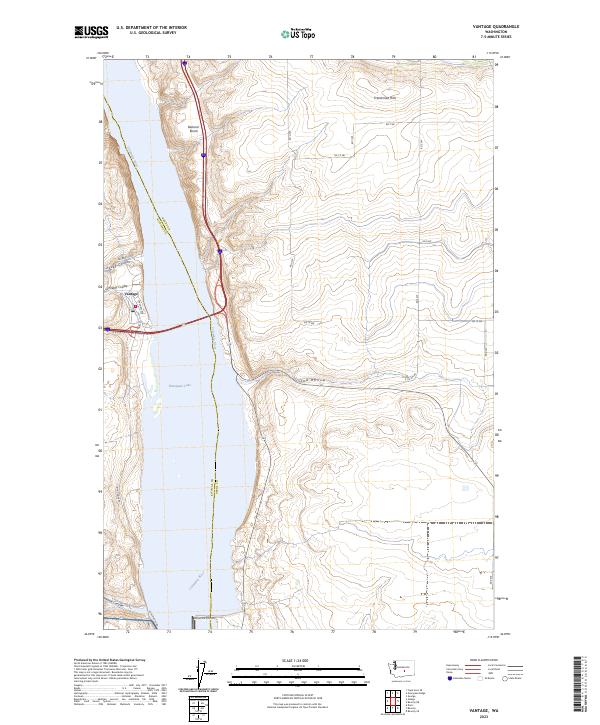
2023 Map of Vantage
USGS Topo · Published 2023About this map
The Vantage settlement sits at a critical crossing of the Columbia River, where the landscape is defined by the high plateaus and deep drainage channels of central Washington. This 2023 survey illustrates the complex topography of the Kittitas and Grant county border, dominated by the Wanapum Lake reservoir. The surrounding terrain is marked by significant geographic formations like the Frenchman Hills to the northeast and the wide Babcock Bench following the river’s eastern bank. A series of distinct erosional features, including Rocky Coulee, Schnebly Coulee, and Ryegrass Coulee, cut through the western basalt cliffs toward the water. To the south, the map details the approach to the river via Wanapum Dam Rd and Huntzinger Rd, while the eastern shore remains largely defined by the agricultural grid roads of Sand Hollow.
Find a feature on this map
24 named features on this map. Tap any name to fly to it.
Don’t see what you’re looking for? This feature index may not catch every label — zoom into the map to look around manually.
Map Details
Editions of this 2023 Vantage Map
This is the sole edition of this map. No revisions or reprints were ever made.
Historical Maps of Vantage Through Time
3 maps found