
1941 Map of Vassalboro
USGS Topo · Published 1954About this map
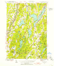
China Lake and the Kennebec River define the agricultural and residential corridors of this central Maine landscape as it was surveyed just before the Second World War. The region is dotted with local education landmarks, ranging from the Oak Grove Seminary in the north to Erskine Academy and numerous rural schoolhouses like Pigeon Plains Sch and Windsor Neck Sch. This distribution of schools and the presence of a Town Farm reflect a well-established network of small farming communities connected by a system of country roads and the winding West Branch Sheepscot River.
Find a feature on this map
71 named features on this map. Tap any name to fly to it.
Don’t see what you’re looking for? This feature index may not catch every label — zoom into the map to look around manually.
Map Details
Editions of this 1941 Vassalboro Map
2 editions found
Other maps of this area

1892 · Gardiner
USGS Topo · 1:62,500

1892 · Waterville
USGS Topo · 1:62,500

1892 · Augusta
USGS Topo · 1:62,500

1893 · Vassalboro
USGS Topo · 1:62,500

1893 · Wiscasset
USGS Topo · 1:62,500

1894 · Norridgewock
USGS Topo · 1:62,500

1898 · Norridgewock
USGS Topo · 1:62,500

1898 · Vassalboro
USGS Topo · 1:62,500

1913 · Waldoboro
USGS Topo · 1:48,000

1915 · Waldoboro
USGS Topo · 1:62,500