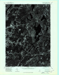
1975 Map of Vassalboro SW
USGS Topo · Published 1981About this map
Togus and the surrounding woodlands of Kennebec County define this orthophotoquad, captured through aerial photography in the mid-1970s. The monochrome imagery reveals a complex network of forest, clearings, and rural homesteads, providing a raw look at the landscape before modern suburban expansion. While most of the sheet is dominated by dense canopy and natural water features like the various unnamed ponds and a Brook, the southern edge contains the organized settlement of Chelsea. This visual record is particularly valuable for identifying the exact footprint of mid-century rural development and the preservation of historic property lines in this part of Maine.
Find a feature on this map
3 named features on this map. Tap any name to fly to it.
Don’t see what you’re looking for? This feature index may not catch every label — zoom into the map to look around manually.
Map Details
Editions of this 1975 Vassalboro SW Map
This is the sole edition of this map. No revisions or reprints were ever made.
Other maps of this area

1892 · Gardiner
USGS Topo · 1:62,500

1892 · Augusta
USGS Topo · 1:62,500

1893 · Vassalboro
USGS Topo · 1:62,500

1893 · Wiscasset
USGS Topo · 1:62,500

1898 · Vassalboro
USGS Topo · 1:62,500

1941 · Vassalboro
USGS Topo · 1:62,500

1941 · Augusta
USGS Topo · 1:62,500

1943 · Augusta
USGS Topo · 1:62,500

1943 · Gardiner
USGS Topo · 1:62,500

1943 · Vassalboro
USGS Topo · 1:62,500