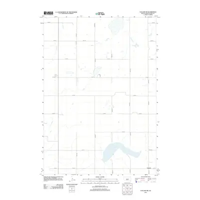
2012 Map of Vayland SW
USGS Topo · Published 2012About this map
Danforth sits at the southern edge of this Hand County landscape, marking a quiet junction in the expansive prairie terrain of central South Dakota. The topography is defined by the subtle drainage of Turtle Cr in the northwest and the prominent curve of Spring Lake in the southeast. This 2012 survey illustrates a highly structured rural grid, where numbered routes like 216th St and 364th Ave intersect with Co Hwy 23 to facilitate movement across the agricultural heartland. The map provides a clear record of land use and water management in a region where seasonal wetlands and small basins dot the section lines between established homesteads.
Find a feature on this map
18 named features on this map. Tap any name to fly to it.
Don’t see what you’re looking for? This feature index may not catch every label — zoom into the map to look around manually.
Map Details
Editions of this 2012 Vayland SW Map
This is the sole edition of this map. No revisions or reprints were ever made.
Other maps of this area

1949 · Vayland SE
USGS Topo · 1:24,000

1949 · Vayland SW
USGS Topo · 1:24,000

1950 · Vayland
USGS Topo · 1:24,000

1950 · Vayland NW
USGS Topo · 1:24,000

1951 · Vayland SW
USGS Topo · 1:24,000

1951 · Vayland SE
USGS Topo · 1:24,000

1953 · Huron
USGS Topo · 1:250,000

1954 · Huron
USGS Topo · 1:250,000

1973 · Ames
USGS Topo · 1:24,000

1973 · Big Bend Dam 4 NE
USGS Topo · 1:24,000